Future Aerial offer drone solutions and mapped data to enable accurate decision making across a range of sectors.
Managing Your drone operations so you can focus on what matters
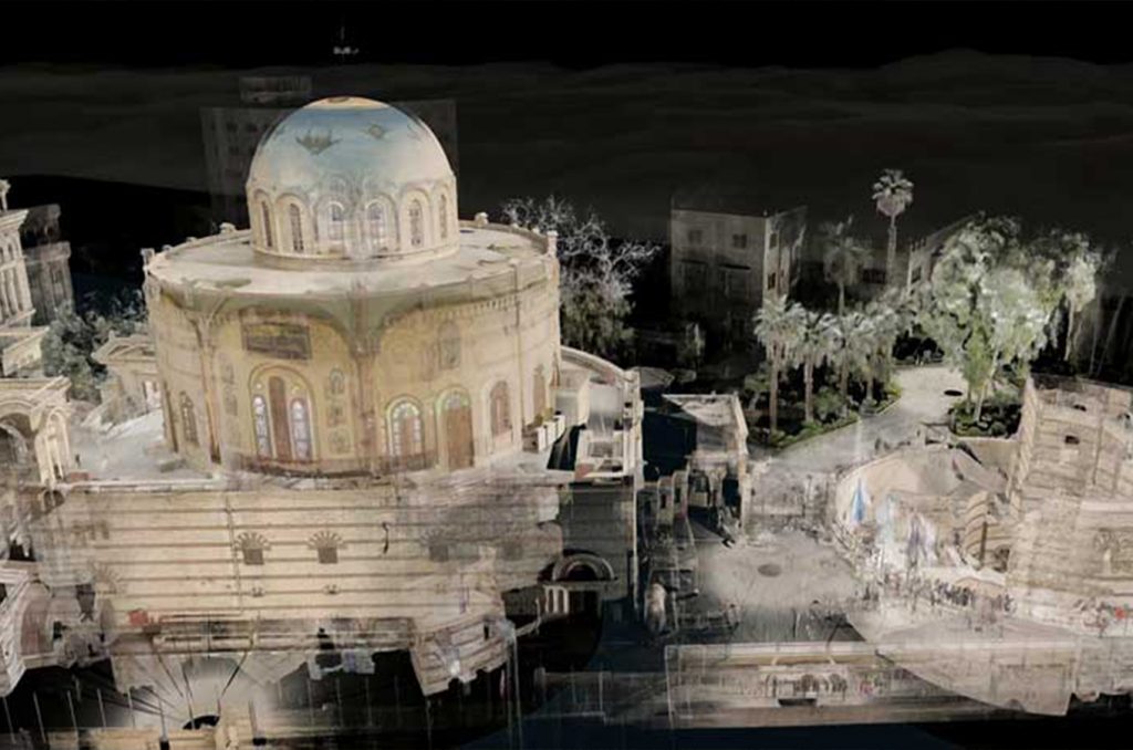
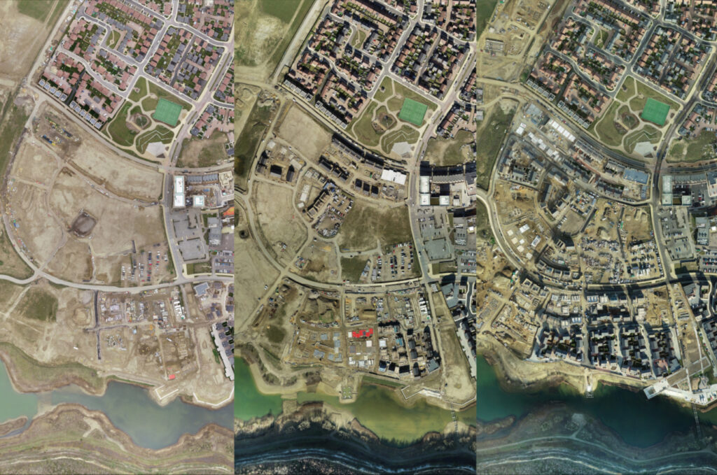
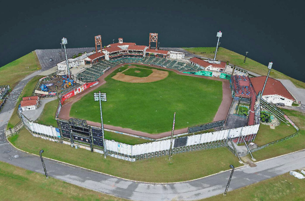
The adoption of drone technology has reshaped traditional workflows in many industries, not only by enhancing safety and enabling remote working but also by providing data to create 3D datasets and virtual simulations of the built and natural world.
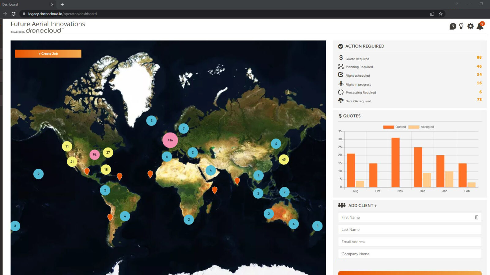
If you have a requirement for repeat drone data collection or a large quantity of drone-related projects to fulfil, our Managed Drone Service is here to help, giving you time to focus on your core business.
Services available across the UK and internationally
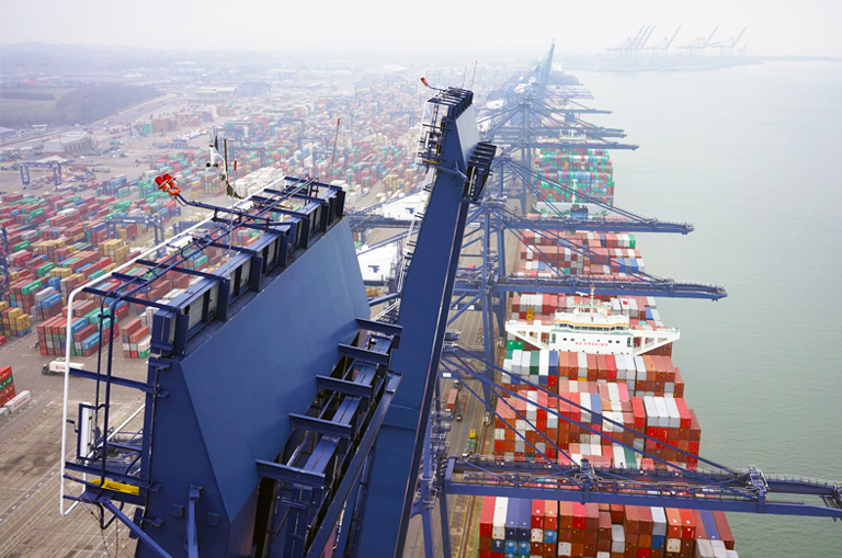
Drone regulations differ in almost every country, as some of the first commercial drone pilots in the UK, we are experts at navigating complex international regulations. Let Future Aerial take the stress out of working with local sub contractors, our team of in-house geospatial experts ensure you receive a consistent quality of deliverable anywhere on the planet.
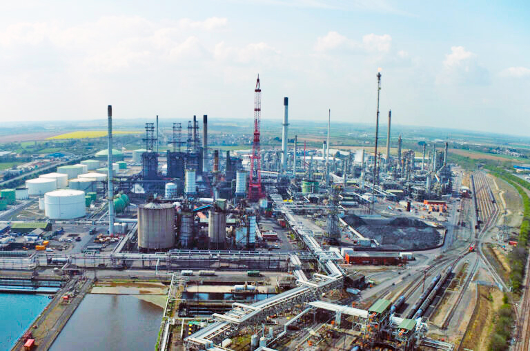
Future Aerial takes the hassle out of running your own internal drone operations. We’ll organise spec’ing, searching for operators and complying with local regulations (UK and international)…
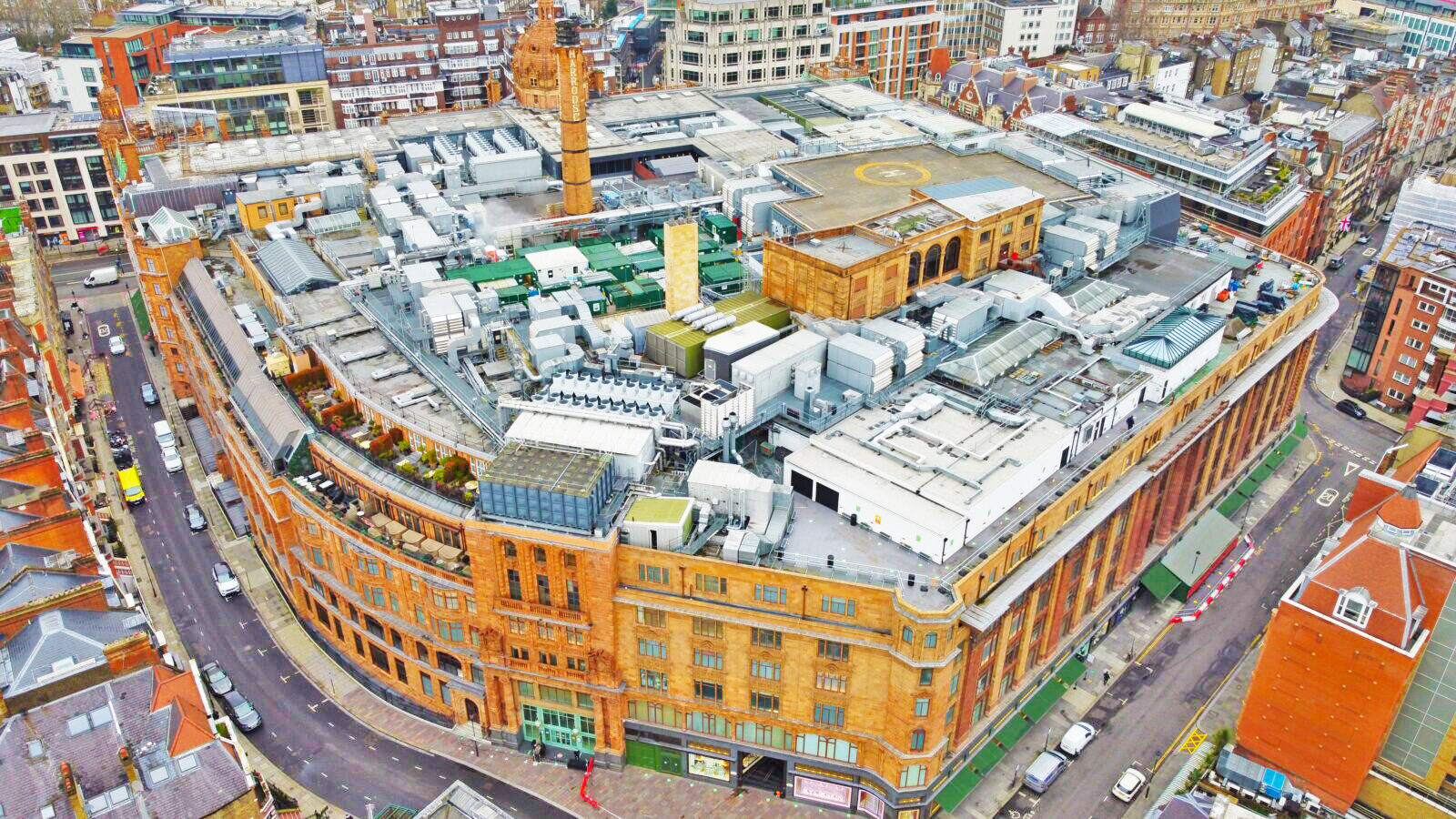
Our digital twins provide an accurate virtual environment. By utilising the most advanced UAV technology (rotary and fixed wing) we collect aerial imagery and data for.
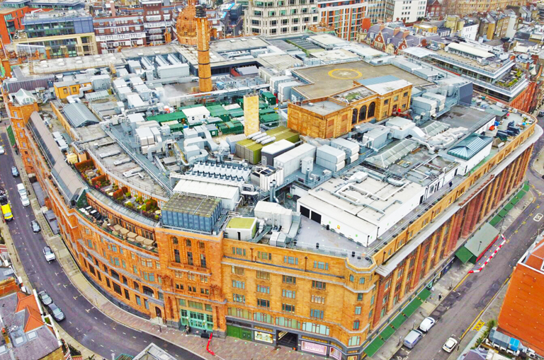
Accessing roofs and facades of buildings can be both costly and time consuming, with feasibility constraints for even the tallest cherry pickers. Our permission from the Civil Aviation Authority allows us to…
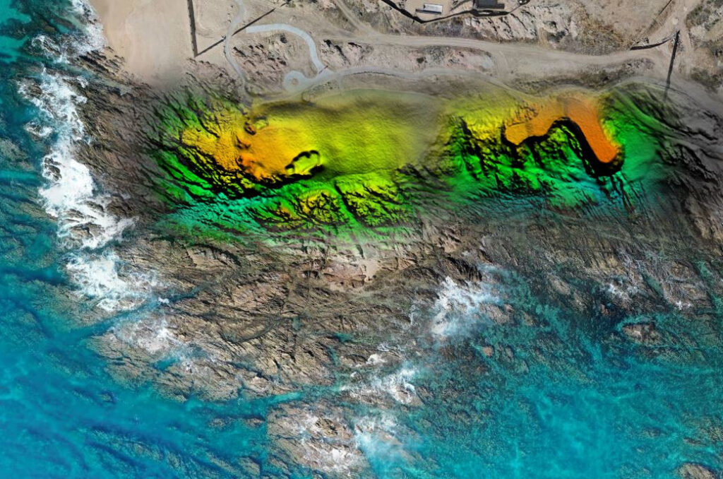
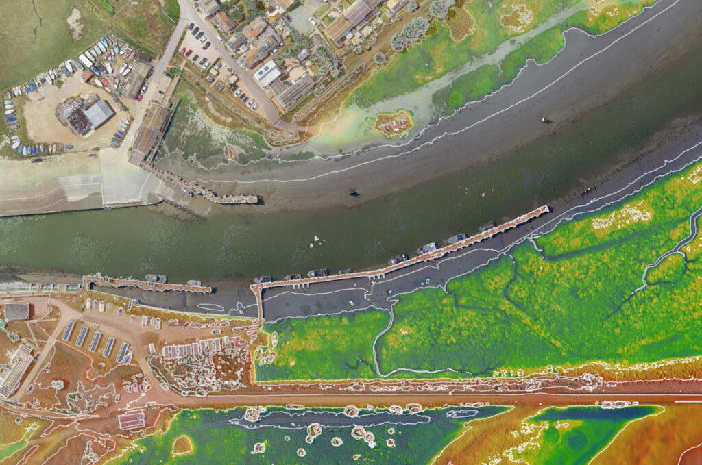
Future Aerial use drones to provide accurate and consistent data to increase flood resilience and protect people globally from this type of natural disaster…
Lorem ipsum dolor sit amet, consectetur adipiscing elit, sed do eiusmod tempor incididunt ut labore et dolore magna aliqua. Ut enim ad minim veniam, quis nostrud exercitation ullamco laboris nisi ut aliquip ex ea commodo consequat.
Lorem ipsum dolor sit amet, consectetur adipiscing elit, sed do eiusmod tempor incididunt ut labore et dolore magna aliqua. Ut enim ad minim veniam, quis nostrud exercitation ullamco laboris nisi ut aliquip ex ea commodo consequat.